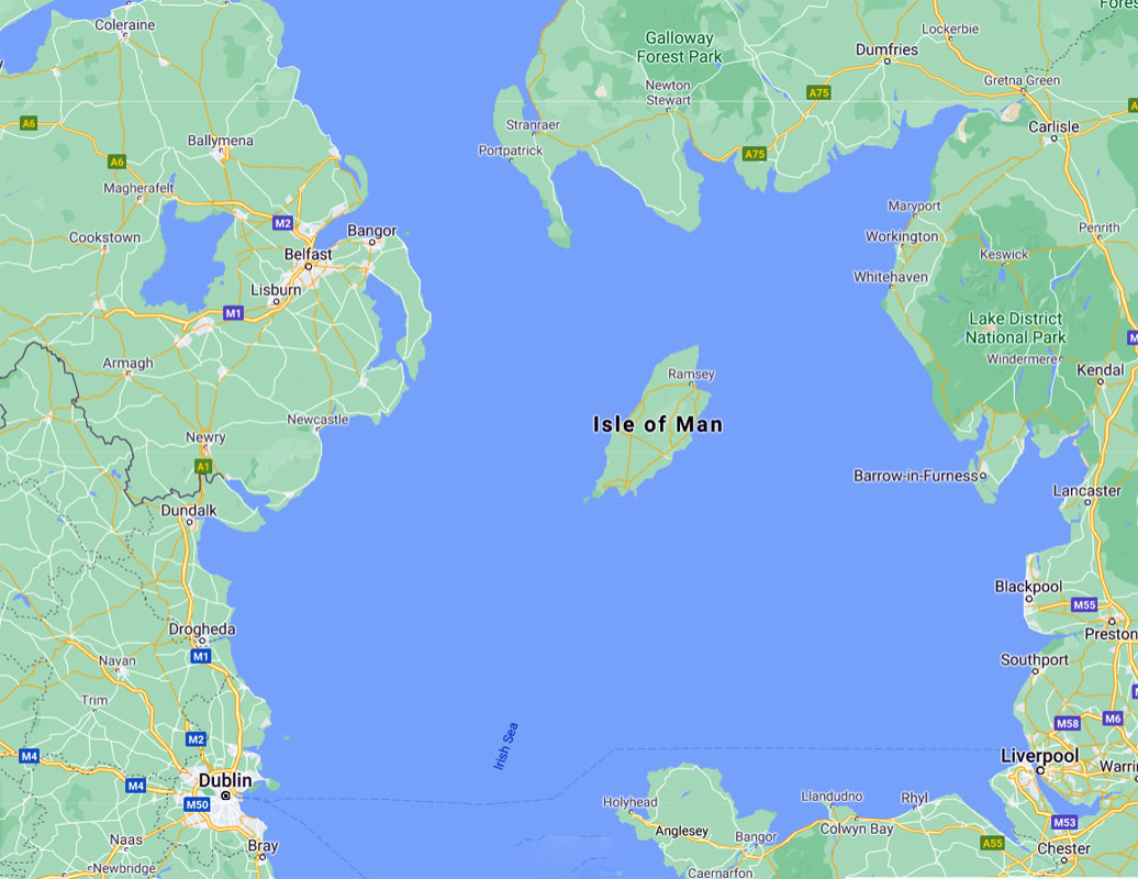
Isle of Man
The population is 83,000 of whom about 50% are native born, and the othe 50% mainly from the rest of the UK. It is 32 miles long and 14 miles wide
The island was cut off from the surrounding islands around 8000 BC as sea levels rose following the end of the ice age. Humans colonised it by travelling by sea some time before 6500 BC. The first occupants were hunter-gatherers and fishermen. Examples of their tools are kept at the Manx Museum.
- The Neolithic Period marked the beginning of farming, and the people began to build megalithic monuments, such as Cashtal yn Ard near Maughold, King Orry's Grave at Laxey, Meayll Circle near Cregneash, and Ballaharra Stones at St John's. There were also the local Ronaldsway and Bann cultures.
- During the Bronze Age, the size of burial mounds decreased. The people put bodies into stone-lined graves with ornamental containers. The Bronze Age burial mounds survived as long-lasting markers around the countryside
- The ancient Romans knew of the island and called it Insula Manavia. Scholars have not determined whether they conquered the island.
- Around the 5th century AD, large-scale migration from Ireland precipitated a process of Gaelicisation, evidenced by Ogham inscriptions, and the Manx language developed. It is a Goidelic language closely related to Irish and Scottish Gaelic
- Vikings arrived at the end of the 8th century. They established Tynwald and introduced many land divisions that still exist.
- In 1266 King Magnus VI of Norway ceded the islands to Scotland in the Treaty of Perth. But Scotland's rule over Mann did not become firmly established until 1275, when the Manx were defeated in the Battle of Ronaldsway, near Castletown.
- In 1290 King Edward I of England sent Walter de Huntercombe to take possession of Mann. It remained in English hands until 1313, when Robert Bruce took it after besieging Castle Rushen for five weeks.
- In 1314, it was retaken for the English by John Bacach of Argyll.
- In 1317, it was retaken for the Scots by Thomas Randolph, 1st Earl of Moray and Lord of the Isle of Man. It was held by the Scots until 1333.
- For some years thereafter control passed back and forth between the kingdoms until the English took it for the final time in 1346.
- The English Crown delegated its rule of the island to a series of lords and magnates. Tynwald passed laws concerning the government of the island in all respects and had control over its finances, but was subject to the approval of the Lord of Mann.
- In 1866, the Isle of Man obtained limited home rule, with partly democratic elections to the House of Keys, but the Legislative Council was appointed by the Crown. Since then, democratic government has been gradually extended.
The Isle of Man has designated more than 250 historic sites as registered buildings.
Towns
- Douglas – the capital and largest town on the island.
- Castletown – a fine castle and the Old House of Keys.
- Peel – an impressive castle, cathedral and nice museums.
- Ramsey – beach and harbour for yachts.
- Laxey – delightful village on the electric railway between Douglas and Ramsey. Noted for its water wheel (claimed to be the world's largest in operation), its mines railway and an electric railway to the top of Snaefell.
- Port Erin – is a seaside village in the south west.
- Port St Mary – village in south west.
- St John's – a small village, next to Tynwald Hill. It was the site of the Isle of Man's first parliament; thousands head here every Tynwald Day (July 5th) to witness the proclamation of new laws read in Manx and English.
- Calf of Man – small island bird sanctuary.
- Silverdale Glen - Owned by the Manx National Trust, it has well laid out paths that lead past small waterfalls and through dense woodland. Look out for the Medieval Monks' Bridge in Ballasalla, which links Silverdale Glen to the historic Rushen Abbey, and the Monks Well which is a perfect place to throw in a few pennies and make a wish. An extensive playground area and pretty boating lake are also available. On site you’ll find a restaurant and well-stocked gift shop.
- Snaefell – During summer, take the tram to the summit of Snaefell, the highest point on the island. From the summit, the visitor can see 6 Kingdoms (Scotland, England, Wales, Ireland, the Isle of Man and Heaven). It is a unique experience in that from the summit you can see the whole Island and the bodies of water that surround it. There is also a hiking trail to the summit that takes only about half an hour.
See
- Laxey Wheel. A restored waterwheel operational during the summer months.
- Located in Castletown, the ancient capital of the Isle of Man, Castletown, the impressive fortress of Castle Rushen.
- Peel. Situated on St Patrick’s Isle, Peel Castle was originally a place of worship before becoming the fort of Magnus Barefoot – an 11th-century Viking King of Mann. Also located on the Peel Quayside is the House of Manannan, a museum of the island's story from Celtic times through the Viking period to 19th-century Peel.
- The Sound Visitor Centre, near Port St Mary. One of the most picturesque points in the south of the Island.
- Cregneash, near Port St Mary. A preserved and restored small Manx crofting village in the far south of the island.
Lisbon to London to London trip