
We walked the entire length of the Victoria Lines in November 2024. Split over 5 days. It was one of the most energetic things we have done in recent years. Not all legs we did, were in the same direction, but my narrative has them all going the same way, otherwise it is incomprehensible. . It is in places strenuous, but as of 2024, perfectly doable
The Victoria Lines, originally known as the North West Front, are a line of fortifications that spans 12 kilometres along the width of Malta, dividing the north of the island from the more heavily populated south. The Lines run along a natural geographical barrier known as the Great Fault, from Madalena in the east, past the town of Mosta in the centre of the island, to Bingemma on the west coast.
Built by the British military in the late 19th century, the line was designed to present a physical barrier to an invading force landing in the north of Malta, intent on attacking the harbour installations to the south, which were vital for the the British fleet. Although never tested in battle, this system of defences combine different types of fortifications—forts, batteries, entrenchments, stop-walls, infantry lines, searchlight emplacements and howitzer positions—constituted a unique ensemble of varied military elements all brought together to enforce the strategy adopted by the British for the defence of Malta in the latter half of the 19th century..The Victoria Lines owe their origin to a combination of international events and the military realities of the time. The opening of the Suez Canal in 1869 highlighted the importance of the Maltese islands.
And last point the geology. There are "Gaps" were the Victoria Line has been broken by roads. And there are Wadis, deep ravines that have been etched out by water over time, and are crossed by the Lines using fortified "stopwalls" or stone bridges

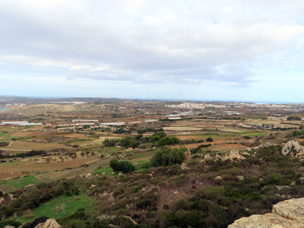
Mgarr to Fort Bingemma
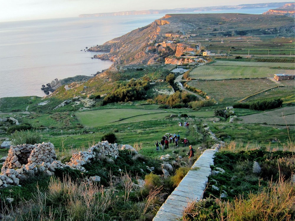
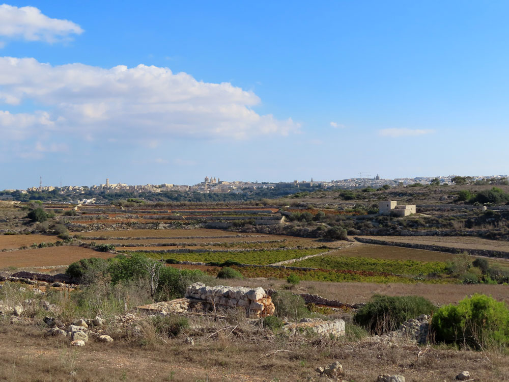
An Uber to Mgarr, then we walked down to the sea where the Lines originally began.

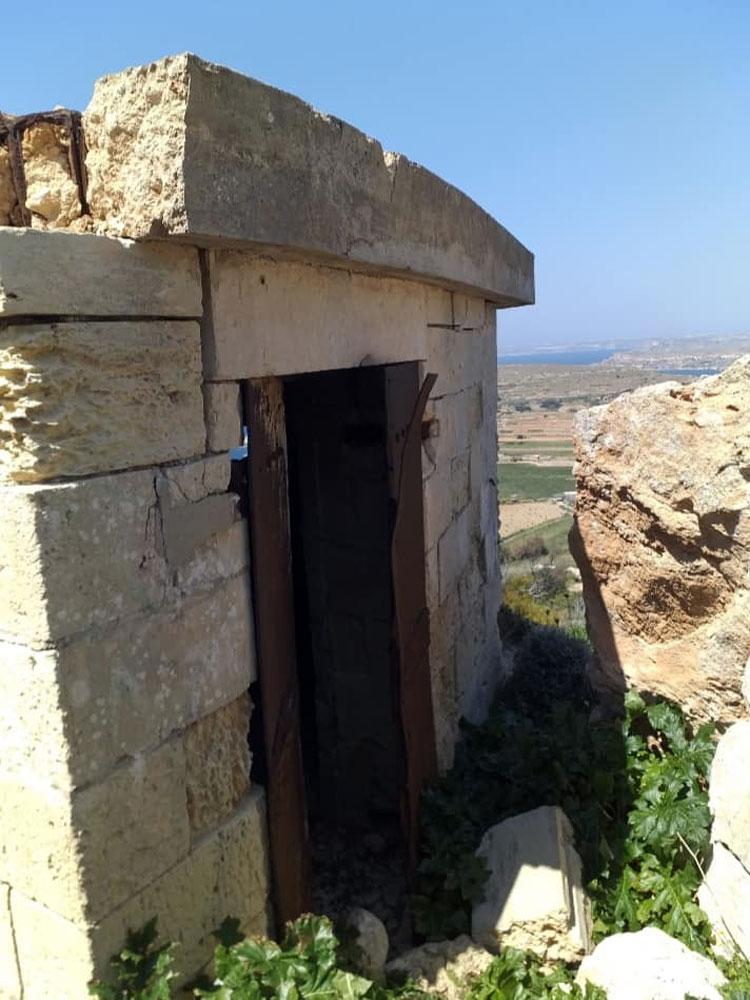
Little remains of the wall until you get to the plateau. It is an easy walk from Mgarr till you get to a point on the road that has been barred by "No Entry" signs claiming that it is private land further on. However there is a steep path off the road towards a WW2 pillbox, and after a bit of huffing and puffing on this track, you get past the pillbox and on to the plateau. It is here that you get your first sight of the "wall". The original start to the wall appears to have been a small fortification, a redoubt, where there is an agricultural reservoir today (roughly centre of photo below), ant it uses part of the redoubts trenching to create the reservoir.
Click on any of the smaller photos to enlarge them
 |
 |
 |
 |
 |
 |
 |
 |
 |
 |
 |
 |
 |
 |
 |
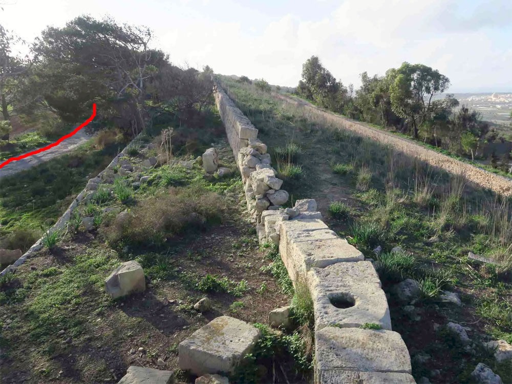
From the Pillbox you can follow the wall for a short distance ...but after that you are on asphalt road to Fort Bingemma
Between il-Kuncizzjoni and Fort Bingemma is the Tas-Santi Gap. You cannot walk along the original Victoria Lines patrol path in this area. This deviation is currently necessary because:
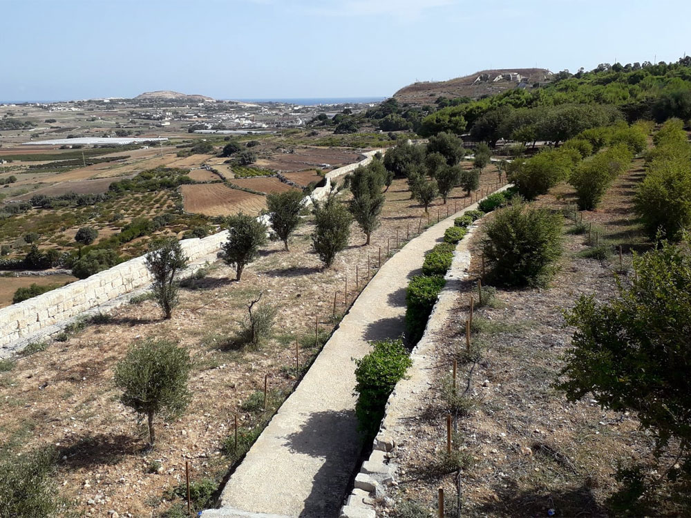
Having made this forced deviation along paved countryside roads; the Victoria Lines trail rejoins the original patrol path at Fort Bingemma. From then onwards, it is basically possible to follow the original wall and patrol path all the way to Fort Mosta; where a second deviation is necessary in the Wadi il-Ghasel area because of the large quarry between Mosta and Naxxar.
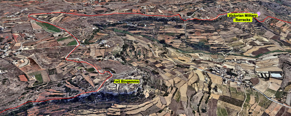
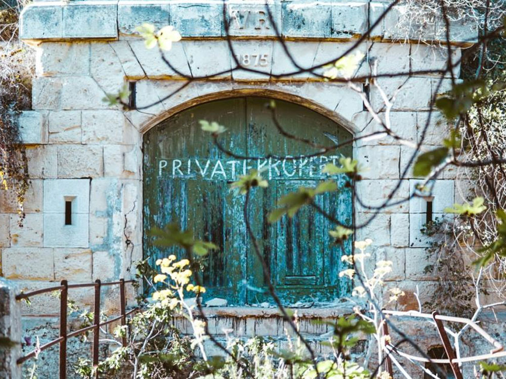
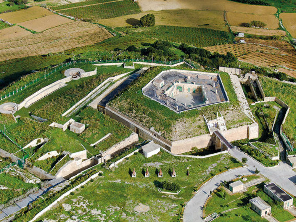
Fort Bingemma
It is one of three forts built along the lines, the other two being Fort Madalena and Fort Mosta. It was the first to be built, with construction taking place between 1875 and 1878. It has an irregular shape, and is protected by a cliff face to the north and a ditch to the south. It was armed with two 6-inch and one 9.2-inch breech-loading guns which had an arc of fire of 210 degrees, commanding the sea to the northwest and the ridges to the northeast.
Later, it was used for military training and communications. Now the Fort is neglected but still intact.
The Fort is now illegally occupied by a Maltese family. Since 1981, the Buttigieg family used the Fort as a farm, but their lease ended in 2009. Although different governments have tried to reclaim the Fort, the Buttigieg family has kept the authorities out. They even built a pool and a restaurant there.

Click on any of the smaller photos to enlarge them
 |
 |
 |
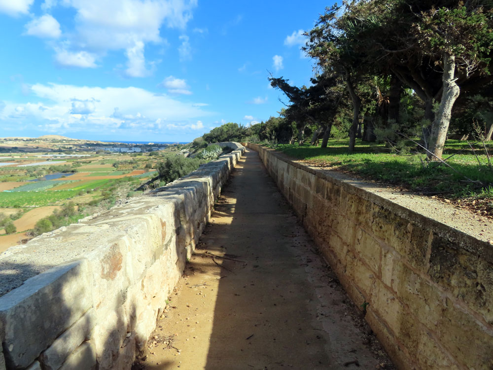
You go round the side of the fort to pick up the path. It’s easy to navigate; follow the wall. From here on the trail is rough, but fairly level. It is comparatively easy to follow, but you do have to keep your wits about you whenever you get to a road or a house, that you pick up the trail correctly after it.
We just followed the track which is narrow but well trod and eventually saw the Hodegetria Chapel below us. It presents a very picturesque view with the north of Malta behind it. The chapel is out of the way, but it’s worth a visit. It’s open on Sundays, but walking around in the surroundings is very rewarding There are caves in the valley below the church. You can reach the caves (which we did not try) by walking down on the right side of the church.
At the chapel we crossed a tarred road and on the other side down a steep path that is a bit difficult to scramble down. Then across one of the fortified wadi bridges, and up very steeply up the other side. The defensive bridge is over a valley called Bingemma Gap.
Fort Bingemma to Bingemma Gap

Click on any of the smaller photos to enlarge them
 |
 |
 |
 |
 |
 |
 |
 |
 |
 |
 |
 |
Birgemma Gap to Birgemma Stopwall, Dwerja Lines and Falka Gap
The track continues across the tar road, and is a steep , rough section to get down, across the Bingemma Stopwall, then up the other side
At the top of the wadi the Dwejra Lines begin. You know you are at the Dwejra Lines as the narrow trail turns into a dirt road
The Dwejra Lines were built to enhance the North-West Front which roughly followed the Great Fault. The Dwejra Lines are about one kilometre in length with a rampart, ditch, six sally ports, six scarp galleries, and one caponier. There is a wide terreplein behind the ramparts, and this had positions built into it for field howitzers. The Dwejra Lines were built between 1878 and 1881 and army returns indicate is was never fully armed. By the 1890s the Dwejra Lines had been absorbed into the Victoria Lines.
There is over a km of level track here, which eventually becomes a concrete road. The Dwejra Lines are today used extensively by Maltese families for barbeques and days out. As it was the schools half term, we saw a couple of dozen groups in the trees, each complete with table, chairs, gas stoves , etc.
You can see both the east and west sides of Malta from here. It’s pretty incredible. The route follows a trench, part of the fortifications. There are also gun emplacements visible along the way.
There is a deep moat/ditch around the end of the Dwejra Lines. Even today this still defeats anyone wanting to pass, so there is a very short deviation from the wall around a U-bend in the road, to get back on the line of the wall
The track runs along the wall and drops down to the main road at the Falka Gap
Click on any of the smaller photos to enlarge them
 |
 |
 |
 |
 |
 |
 |
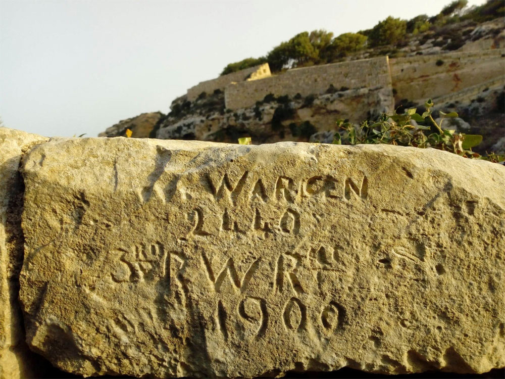 |
| I have researched this and this is the man named | |||
 |
 |
 |
 |
 |
 |
 |
 |
 |
 |
 |
 |
 |
 |
 |
 |
Falka Gap to Mosta Gap (Targa Gap)
At the main road the path goes almost straight over, and becomes a minor on the other side. The road is busy and traffic fairly continuous in both directions, so you take you life in your hands to cross
There is then a fairly long section on this paved minor road, but is used as a rat run by locals, which means there were a small number of speeding cars.
Along the road are cavernous limestone quarries that are deserted on weekends. You’ll see some posh houses and camping areas. We passed land that is owned by the Malta Boy Scouts, which was a Targa Gun Battery
The minor road eventually takes you to another main road. This is called the Targa Gap. And goes into Mosta
Click on any of the smaller photos to enlarge them
 |
 |
 |
 |
| Hedgehog warning | Targa Gun Battery | Limestone Quarry | and the main road |
Mosta Gap to Naxxar Gap

We walked this bit of the Victoria Lines even though the Lines have all but disappeared, and one has to walk along a busy main road , which is much safer now that a crash barrier has been installed between pedestrian & traffic.
From the end of the last section, you cross the road to reach the Mosta Bride Garden. In this area, the wall has been restored. This park has benches and play areas.
The path ends at the security fence for Fort Mosta. You can either try to scramble round below the fort, which is difficult, or walk back to the road and take that over Mosta Bridge, in order to pick up the trail. We chose the later
Click on any of the smaller photos to enlarge them
 |
 |
 |
 |
 |
 |
 |
 |
The end of the path at the Fort Mosta security fence
Fort Mosta

There’s Fort Mosta to the east. Fort Mosta was built as part of the Victoria Lines. The fort has a pentagonal shape and a battery. Today Fort Mosta is an ammunition depot for the Armed Forces of Malta and isn’t open to the public.
Fort Mosta to Naxxar Gap
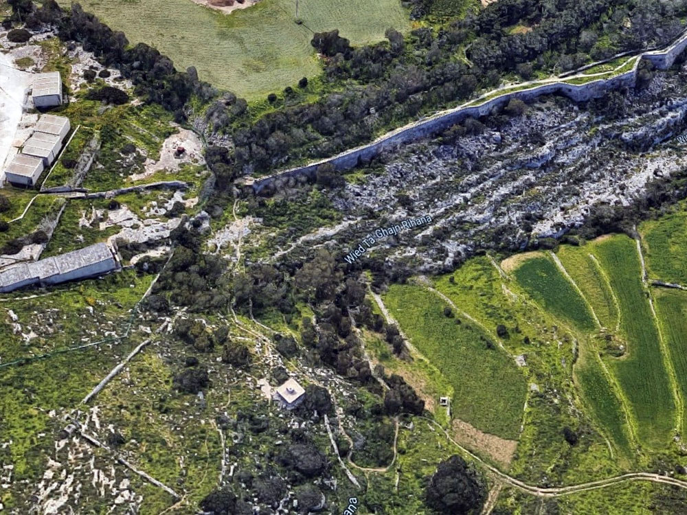
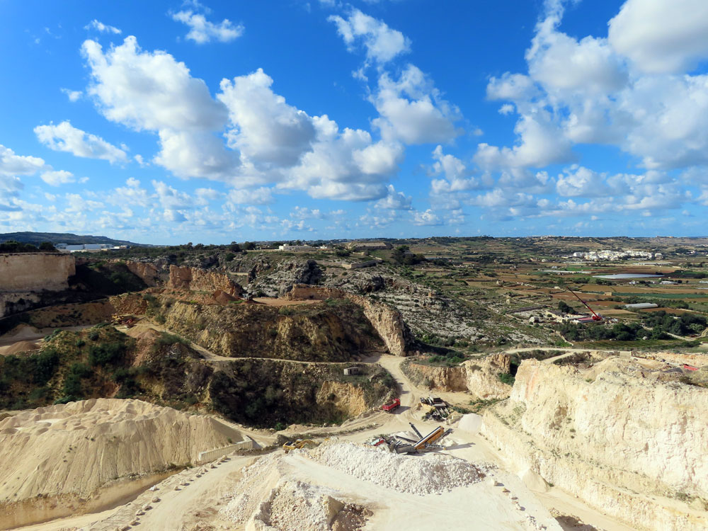
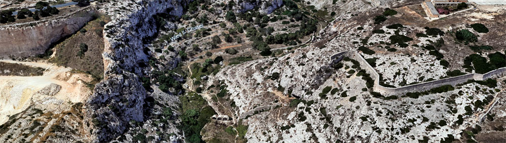
The Victoria Lines wall did continue across the Wadi, but a flood in the 1970's removed all but the 3 arches of the original stopwall.
The quarries are vast, and have completely destroyed a long section of the wall
The wall then can be (just) discerned running along the main road, as can be seen in the aerial photos below
Click on any of the smaller photos to enlarge them
 |
 |
 |
 |
 |
 |
 |
 |
 |
 |
 |
 |
The Victoria Lines have now disappeared from the quarry to the Naxxar Gap. Removed by the quarrying, then by a major road
The end of the wall after Fort Mosta. and the remains of the stopwall in the wadi


The Victoria lines running beside the main road near Naxxar Gap
Naxxar Gap to Top of the World

We did this stretch starting from Top of the World view point. But this description is the other way for consistency with the rest of our narrative
The wall has petered out over the last 200 metres to the Naxxar Gap, but after that a sign points to the trail. The route is via a gerry built limestone block set of stairs to the trail, which runs level along the edge of the escarpment, until it reaches wadi Anglu
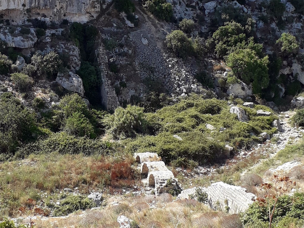
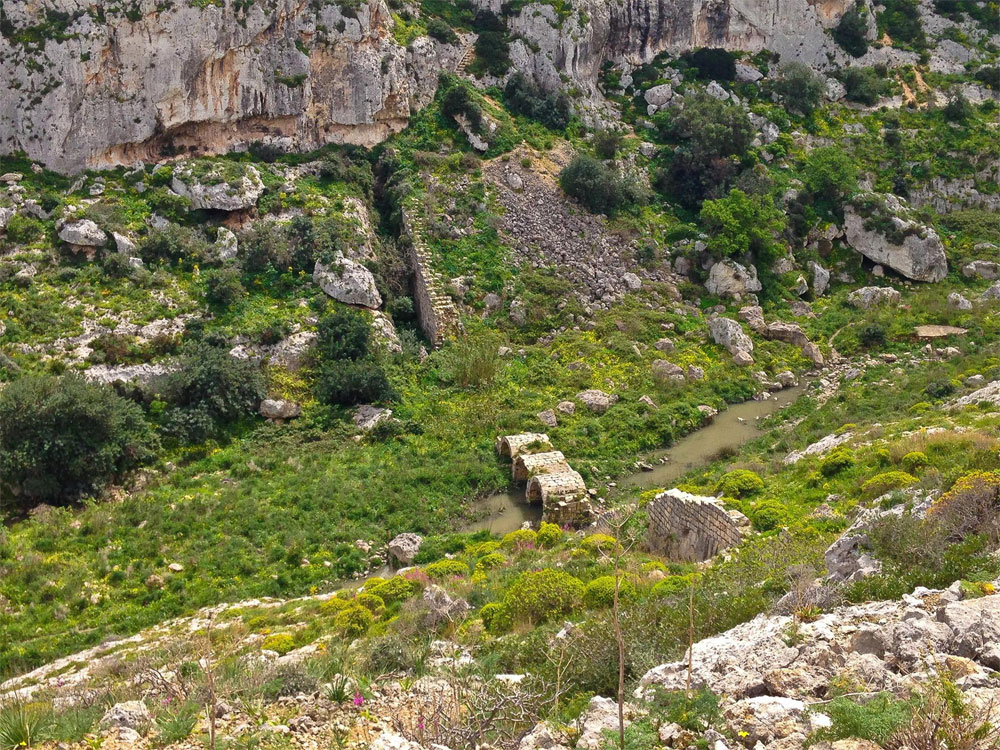
To cross the wadi, the defensive wall runs down a long flight of stone steps to a "bridge" over the wadi.. We were a bit doubtful as to whether the bridge was going to be wide enough to safely walk over, but we need not have been concerned, it was wide. Then up another long flight of steps on the other side to get back to the plateau, This is the Anglu Stopwall

The Anglu Stopwall, the most scenic Stopwall on the Lines
Click on any of the smaller photos to enlarge them
 |
 |
 |
 |
 |
 |
 |
 |
 |
 |
 |
 |
 |
 |
 |
 |
| End of this section, looking across the road to the next section |
The exit from the Victoria Lines path onto the road at Top of the World was full of newly cut stone awaiting to repair the defensive wall.
We left and later rejoined the trail here. The road runs us back to Naxxar, and en route there was a nice new cafe , called if you would believe "Top of the World"
Top of the World to Fort Madalena via Faham Stopwall & San Giovanni Battery

We re-started at Top of the World viewpoint and walked along the the wall as far as the Gharghur AA Battery. Which was an easy 20 minute walk along a made up track, which was even tarmac in places. There were good views over the north of Malta, though there are a fair number of large industrial buildings, and large apartment blocks on the coast
Click on any of the smaller photos to enlarge them
 |
 |
 |
 |
 |
 |
 |
 |
 |
 |
 |
 |
 |
 |
 |
 |
 |
 |
 |
 |
 |
 |
 |
 |
At the Gharghur AA Battery the wall swung away from the track and we followed the wall, and although the wall had been restored, the "path" beside the wall became very rough. We could see the steps down into the wadi, and up the other side, but as the going did not look any easier. And indeed it was not easy. Underfoot was very uneven on the Gharghur side, and once we crossed the wadi, the path was quite overgrown and a bit of a squeeze to reach the top and the San Giovanni Battery remains
After the battery the Victoria Line wall stops as a new housing development has been built, which blocks the path. We went round the houses by road, and reached Fort Madalena. Now in a mix of Government and Commercial use, it is not possible to visit unless you make an appointment in advance for a Saturday afternoon.
The Victoria Lines then ran down to the sea, but that section has disappeared under redevelopment. We walked on to Fort Pembroke, which is not part of the lines, but was part of Malta's defensive plan

Fort Madalena

This Fort was built in the 19th century as part of the Victoria Lines defence system. With 132 meters of elevation, the fort offers views of Gozo to the south of Malta.
The primary purpose of the structure was to house large guns. A perimeter ditch protected the area from the outside. The fort was designed to complement the natural landscape. Today St John Rescue Corps Malta uses the fort for rescue training.
Fort Pembroke
Fort Pembroke is a polygonal fort in Pembroke . It was built between 1875 and 1878. The fort now houses the Verdala International School who have a lease till 2072
Fort Pembroke was built by the British to defend the Grand Harbour as well as part of the Victoria Lines. The building of the fort was proposed in a defence committee recommendation in 1873. The fort has an elongated hexagonal shape, surrounded by a ditch and glacis. It contained underground magazines and casemated garrison quarters. It was armed with three RML 11 inch 25 ton guns and one 64-pounder gun, which were mounted en barbette.
