Day 8 - Back across the Southern Ocean and the Drake Passage. By dawn we were experiencing heavy seas and 60 kt winds. This was the early stages of yet another gale. All outside decks were closed. By 5pm the wind had dropped a bit to 40 kt winds but the seas were still very rough. Visibility was bad, we were pushing through fog, and could see for about one mile only. By now we had dropped off the global GPS map on our TV screen, as we were too far south. We had quite literally dropped off the map. Antarctica hardly looked attainable when we went to bed in these very blustery conditions.

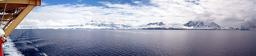
We entered via the west side of Brabant Island, went into Paradise Bay, then headed north via the Gerlache Strait and the ease side of Brabant Island
Day 9 - Antarctica.
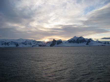
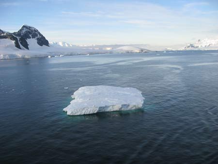
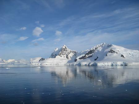
Next morning we set the alarm clock for dawn, just in case... and when we woke there were icebergs floating past our balcony. The sea was close to a flat calm, the sky was almost clear, and the sun was about to rise. Luck, for once, was with us, and we ran up to the deck. Incredibly most of the passengers had got there already, and you had to jostle a bit to get a position on the rails. The sun came up around 5am and the scene was magical as we nosed between bergs and eventually entered Paradise Bay
 |
 |
 |
 |
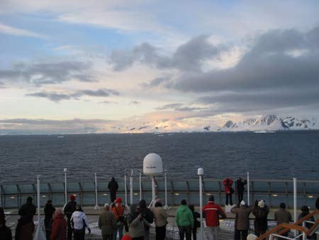
Dawn over Antarctica, everyone is very excited. We push further in, skirting round icebergs
 |
 |
 |
 |
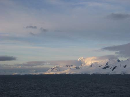
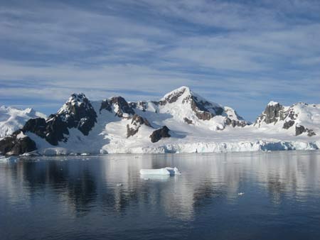
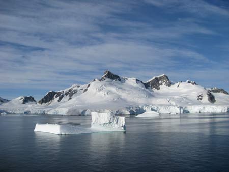
We enter Paradise Bay, the sun is shining. The cold is a dry cold, and with no wind, is quite bearable, though we were well bundled up, just in case.
Paradise Bay is a harbour in West Antarctica. It is one of only two ports used for cruise ships to stop on the continent; the other is Neko Harbour.
The Argentinean scientific base, Almirante Brown Antarctic Base, is located on the banks of Paradise Bay, as is the Chilean scientific base, González Videla Antarctic Base.
 |
 |
 |
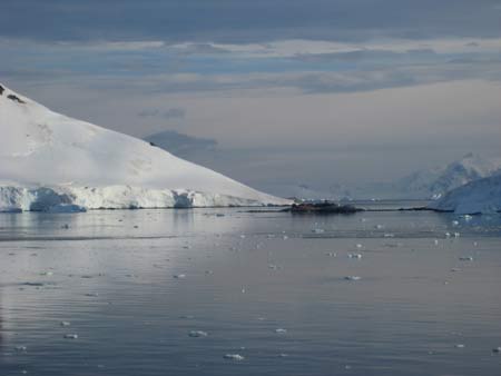
A small expedition ship, the “Hanseatic”, followed us into the bay and stopped at a research station. You can just make out the research station and the ship in the photo to the left. |
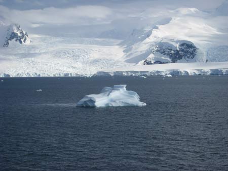
The mountains are thousands of feet high and covered with glaciers and snow fields (technical difference, glaciers move, snow fields do not) 500 feet thick. Icebergs of different sizes and shapes filled the bay.
 |
 |
 |
 |
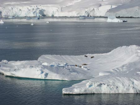
Icebergs everywhere, and most contained either seals or penguins. Here some leopard seals are relaxing in the sun after whatever they enjoyed for breakfast.
 |
 |
| The Argentine base | and the Chilean base |
| More seals as we cruise round the bay |  |
 |
 |
 |
 |
 |
 |
With a blue sky, and reflections in the water, the bay was stunning.
 |
 |
 |
The bergs without seals had penguins sitting on top. There were also penguins swimming in the waters. |
 |
 |
 |
 |
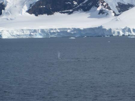
Whales are difficult to photograph: anyway these, believe it or not, are whales spouting and diving.
 |
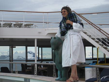 |
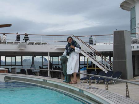
Time for a swim, Antarctica in the background |

And we head north again after the brief but memorable stop in Paradise Bay
Gerlache Strait or De Gerlache Strait or Détroit de la Belgica is a channel/strait separating the Palmer Archipelago from the Antarctic Peninsula. The Belgian Antarctic Expedition, under Lt. Adrien de Gerlache, explored the strait in January and February 1898, naming it after the expedition ship Belgica. The name was later changed to honour Gerlache himself.
As we left the Gerlache Strait, the weather suddenly went from sunshine and clear visibility to blowing snow and limited visibility. As we headed north into the Southern Ocean , the seas became very rough for the rest of the day and night as we went through 15 foot seas and 40 knot winds.