
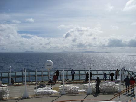
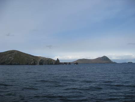
Day 6 - We reached Cape Horn around 1pm, took on board the Chilean Pilot, and spent 4 or 5 hours circumnavigating the island. The sea was abnormally benign.
Cape Horn island (Dutch:Kaap Hoorn Spanish : Cabo de Hornos; named after the city of Hoorn in the Netherlands) is the southernmost headland of the Tierra del Fuego archipelago of southern Chile.
The waters around Cape Horn are particularly hazardous, owing to strong winds, large waves, strong currents combining to create a climatic mix that wrecked countless ship.The opening of the Panama Canal in 1914 reduced the number of ships rounding Cape Horn and steam power, rather than sail made it easer for ships to steam against the prevailing westerly winds.
Cape Horn is 56° south: it is south of the southern tip of Africa at 35° south and of the southern tip of New Zealand at 47° south. The prevailing winds blow from west to east around the world without any land to brake their progress. So we get the "roaring forties" and the wilder "furious fifties" and the even wilder "screaming sixties".
The strong winds of the Southern Ocean give rise to large waves; these waves can attain enormous size as they roll around the Southern Ocean. At the Horn waves encounter an area of shallow water to the south of the Horn, which has the effect of making the waves shorter and steeper, greatly increasing the hazard to ships. In addition to these "normal" waves, the area west of the Horn is particularly notorious for rogue waves, which can attain heights of up to 30 metres (100 ft).
All in all Cape Horn is notorious as the most dangerous ship passage in the world; many ships were wrecked, and many sailors died, attempting to round the Cape.
We approach the Cape in the comfort of a 90,000 ton ship, on a calm day
 |
 |
 |
 |
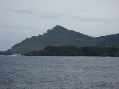
Cape Horn loomed up on the horizon, the pilot came on board. There is a Chilean military/pilot station here, which can be seen in the photos. Not exactly a plum posting for Chilean soldiers, but over the years friction with Argentina over who owns the islands has led Chile to be prepared.
 |
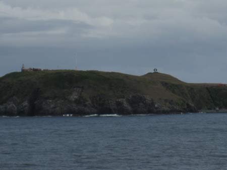 |
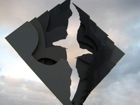
| Cape Horn, with the Chilean base in front | The Chilean base, lighthouse and Albatross Sculpture |
The famous "albatross sculpture" is part of the Chilean base. The statue was erected in 1992 in memory of the men of the sea from every nation that lost their lives fighting against the merciless forces of nature of the Southern Ocean that prevail in the vicinity of Cape Horn.
 |
 |
 |
 |
Swept by wind and storm for most of the year, the Island of Cape Horn is rocky and bleak, without trees which cannot establish a foothold under these conditions. We sailed round anti-clockwise and emerged from the Pacific into the Atlantic. The pilot was dropped off around 4pm and we headed towards Ushuaia, which we reached the following morning